
Datei:Map of Illinois highlighting LaSalle County.svg

Größe der PNG-Vorschau dieser SVG-Datei: 336 × 599 Pixel. Weitere Auflésungan: 134 × 240 Pixel | 269 × 480 Pixel | 430 × 768 Pixel | 574 × 1.024 Pixel | 1.148 × 2.048 Pixel | 3.453 × 6.157 Pixel.
Version in hechara Auflesung (SVG-Datei, Basisgress: 3.453 × 6.157 Pixl, Dateigress: 85 KB)
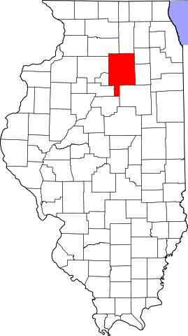
This is a locator map showing LaSalle County in Illinois.
David Benbennick made this map. For more information, see Commons:United States county locator maps.
| Ich, der Urheberrechtsinhaber dieses Werkes, veröffentliche es als gemeinfrei. Dies gilt weltweit. In manchen Staaten könnte dies rechtlich nicht möglich sein. Sofern dies der Fall ist: Ich gewähre jedem das bedingungslose Recht, dieses Werk für jedweden Zweck zu nutzen, es sei denn, Bedingungen sind gesetzlich erforderlich. |
Dateiversiona
Wensd auf an Zeitpunkt klickst, nacha konst a friaane Version lodn.
| Version vom | Vorschaubuidl | Dimensióna | Nutzer | Kommentar | |
|---|---|---|---|---|---|
| aktuell | 15:26, 5. Apr. 2007 | | 3.453 × 6.157 (85 KB) | Ruhrfisch | This is a locator map showing La Salle County in Illinois. David Benbennick made this map. For more information, see Commons:United States county locator maps. {{PD-self}} [[Category:La Salle Count |
Dateivawendung
Seitn wo de Datei nutzn:
Globale Dateinutzung
D'noochéfóiganden åndern Wikis vawénden dé Datei:
- Vawendung af ar.wikipedia.org
- مقاطعة لاسال (إلينوي)
- نورث يوتيكا (إلينوي)
- دالزل (إلينوي)
- كانغلي (إلينوي)
- ليونوري (إلينوي)
- نابلت (إلينوي)
- سينيسا (إلينوي)
- تروي غروف (إلينوي)
- سيدار بوينت (إلينوي)
- دانا (إلينوي)
- غراند ريدج (إلينوي)
- ليلاند (إلينوي)
- لوستانت (إلينوي)
- أوتاوا (إلينوي)
- سترتور
- بيرو (إلينوي)
- لاسال
- مرسيليا (إلينوي)
- إيرلفيل
- ميندوتا
- أوغلسبي
- وينونا
- ميلينغتون (إلينوي)
- رانسوم (إلينوي)
- روتلاند (إلينوي)
- شريدان (إلينوي)
- سوموناك (إلينوي)
- تونيكا (إلينوي)
- قالب:مقاطعة لاسال (إلينوي)
- Vawendung af bg.wikipedia.org
- Vawendung af ca.wikipedia.org
- Llista de comtats d'Illinois
- Cedar Point (Illinois)
- Dalzell (Illinois)
- Dana (Illinois)
- Earlville (Illinois)
- Grand Ridge (Illinois)
- Kangley
- La Salle (Illinois)
- Leland (Illinois)
- Leonore (Illinois)
- Lostant
- Marseilles (Illinois)
- Mendota (Illinois)
- Millington (Illinois)
- Naplate
- North Utica
- Oglesby (Illinois)
- Ottawa (Illinois)
- Peru (Illinois)
- Ransom (Illinois)
Weitere globale Verwendungen dieser Datei anschauen.