
Datei:Luxembourg relief location map.jpg
Gress dea Voaschau: 433 × 599 Pixel Weitere Auflésungan: 173 × 240 Pixel | 347 × 480 Pixel | 829 × 1.147 Pixel.
Version in hechara Auflesung (829 × 1.147 Pixel, Dateigress: 481 KB, MIME-Typ: image/jpeg)
| Bschreiwung |
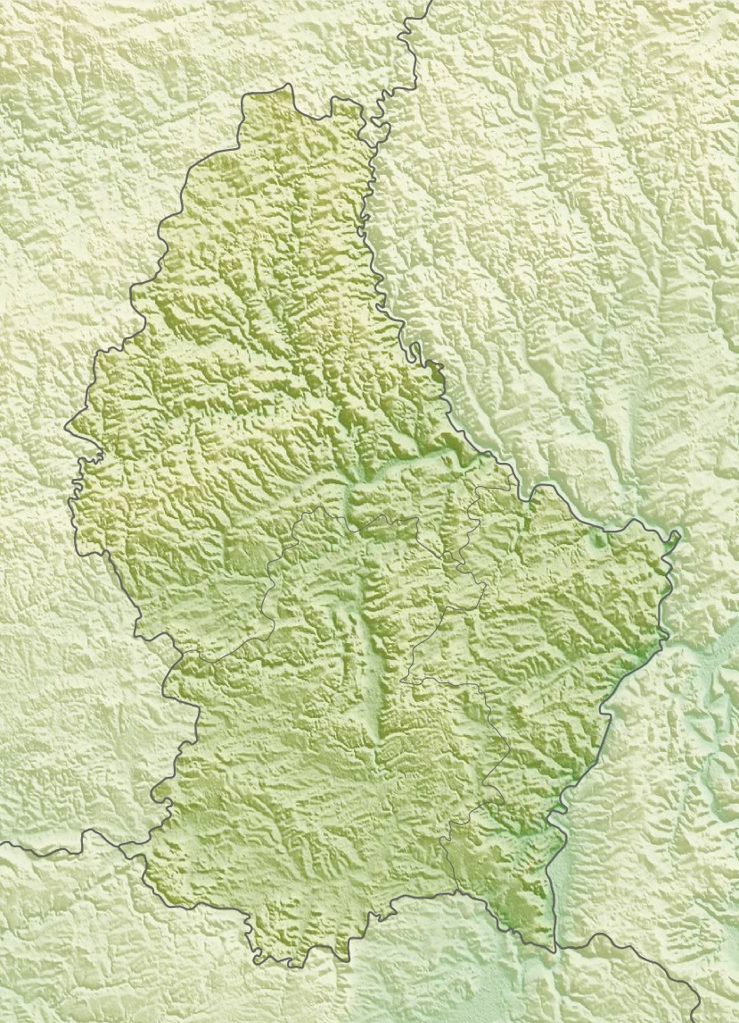
Deutsch: Physische Positionskarte von Luxemburg
Quadratische Plattkarte. Geographische Begrenzung der Karte:
English: Physical location map of Luxembourg
Equirectangular projection. Geographic limits of the map:
|
| Daatum | |
| Quejn | Eigenes Werk, using map data from administrative map by Lencer and SRMT3-data for the relief |
| Urhéwer | Carport |
| Gnémigung (Weidernutzung voh derer Daatei) |
Diese Datei ist unter der Creative-Commons-Lizenz „Namensnennung – Weitergabe unter gleichen Bedingungen 3.0 nicht portiert“ lizenziert.
|
| Aundre Versióner |
|

Dateiversiona
Wensd auf an Zeitpunkt klickst, nacha konst a friaane Version lodn.
| Version vom | Vorschaubuidl | Dimensióna | Nutzer | Kommentar | |
|---|---|---|---|---|---|
| aktuell | 16:39, 10. Mer. 2010 | | 829 × 1.147 (481 KB) | Carport | {{Information |Description={{de|Physische Positionskarte von {{w|Luxemburg|3=de}}}} Quadratische Plattkarte. Geographische Begrenzung der Karte: * N: 50.25° N * S: 49.4° N * W: 5.65° O * O: 6.6° O {{en|Physical location map of {{w|Luxembourg}}}} Equir |
Dateivawendung
Seitn wo de Datei nutzn:
Globale Dateinutzung
D'noochéfóiganden åndern Wikis vawénden dé Datei:
- Vawendung af ar.wikipedia.org
- Vawendung af ast.wikipedia.org
- Vawendung af az.wikipedia.org
- Vawendung af ba.wikipedia.org
- Vawendung af bn.wikipedia.org
- Vawendung af bs.wikipedia.org
- Vawendung af ca.wikipedia.org
- Vawendung af ceb.wikipedia.org
- Vawendung af ce.wikipedia.org
- Vawendung af ckb.wikipedia.org
- Vawendung af cs.wikipedia.org
- Vawendung af cv.wikipedia.org
- Vawendung af de.wikipedia.org
- Vawendung af de.wikivoyage.org
Weitere globale Verwendungen dieser Datei anschauen.