
Datei:Map of Lycoming County Pennsylvania With Municipal and Township Labels.png

Gress dea Voaschau: 800 × 495 Pixel Weitere Auflésungan: 320 × 198 Pixel | 640 × 396 Pixel | 882 × 546 Pixel.
Version in hechara Auflesung (882 × 546 Pixel, Dateigress: 62 KB, MIME-Typ: image/png)
| Bschreiwung |
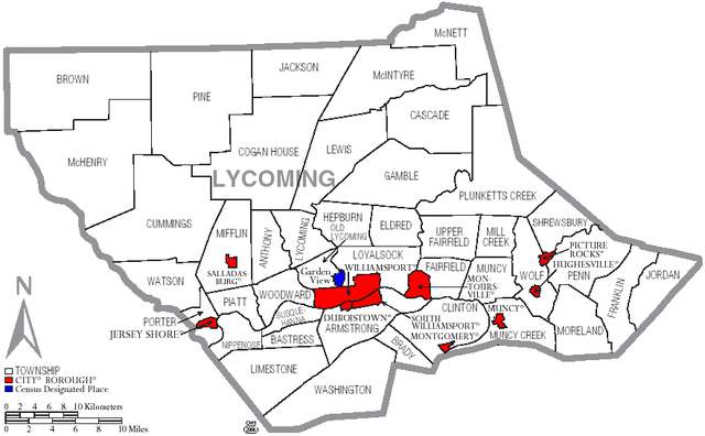
English: Map of Lycoming County with township and municipal bondaries is taken from US Census website [1] and modified by User:Ruhrfisch in August 2005. My modifications licensed under the GNU Free Documentation License. |
| Daatum | |
| Quejn | US Census website [2] |
| Urhéwer | Ruhrfisch |

|
Es ist erlaubt, die Datei unter den Bedingungen der GNU-Lizenz für freie Dokumentation, Version 1.2 oder einer späteren Version, veröffentlicht von der Free Software Foundation, zu kopieren, zu verbreiten und/oder zu modifizieren; es gibt keine unveränderlichen Abschnitte, keinen vorderen und keinen hinteren Umschlagtext.
Der vollständige Text der Lizenz ist im Kapitel GNU-Lizenz für freie Dokumentation verfügbar. |
| Diese Datei ist unter der Creative-Commons-Lizenz „Namensnennung – Weitergabe unter gleichen Bedingungen 3.0 nicht portiert“ lizenziert. | ||
| ||
| Diese Lizenzmarkierung wurde auf Grund der GFDL-Lizenzaktualisierung hinzugefügt. |
Dateiversiona
Wensd auf an Zeitpunkt klickst, nacha konst a friaane Version lodn.
| Version vom | Vorschaubuidl | Dimensióna | Nutzer | Kommentar | |
|---|---|---|---|---|---|
| aktuell | 20:03, 16. Jun. 2006 | | 882 × 546 (62 KB) | Ruhrfisch | {{Information |Description=Map of Lycoming County with township and municipal bondaries |Source=taken from US Census website [http://factfinder.census.gov/] and modified by User:Ruhrfisch |Date=June 2006 |Author= US Census / Government and Ruhrfisch |
| 20:41, 3. Apr. 2006 |  | 882 × 546 (62 KB) | Ruhrfisch | Map of Lycoming County with township and municipal boundaries is taken from US Census website [http://www2.census.gov/geo/maps/general_ref/cousub_outline/cen2k_pgsz/pa_cosub.pdf] and modified by User:Ruhrfisch in April 2006. My modifications licensed | |
| 21:21, 2. Sep. 2005 |  | 981 × 599 (25 KB) | Ruhrfisch | Map of Lycoming County with township and municipal bondaries is taken from US Census website [http://factfinder.census.gov/] and modified by User:Ruhrfisch in August 2005. My modifications licensed under the GNU Free Documentation License. Sourc |
Dateivawendung
Seitn wo de Datei nutzn:
Globale Dateinutzung
D'noochéfóiganden åndern Wikis vawénden dé Datei:
- Vawendung af de.wikipedia.org
- Vawendung af en.wikipedia.org
- Lycoming County, Pennsylvania
- User talk:Cedrus-Libani
- User:Ruhrfisch/Frog
- User:Ruhrfisch/Maps
- History of Lycoming County, Pennsylvania
- List of municipalities in Lycoming County, Pennsylvania
- User talk:SatyrTN/Archive 8
- List of villages in Lycoming County, Pennsylvania
- User talk:Circeus/november2007
- User talk:Cirt/Archive 1
- User talk:Golbez/Archive 3
- Vawendung af ja.wikipedia.org
- Vawendung af nl.wikipedia.org
- Vawendung af pt.wikipedia.org