
Datei:Maps-roman-empire-peak-150AD.jpg
Version in hechara Auflesung (2.620 × 2.076 Pixel, Dateigress: 1,12 MB, MIME-Typ: image/jpeg)
Bschreiwung
| Bschreiwung |
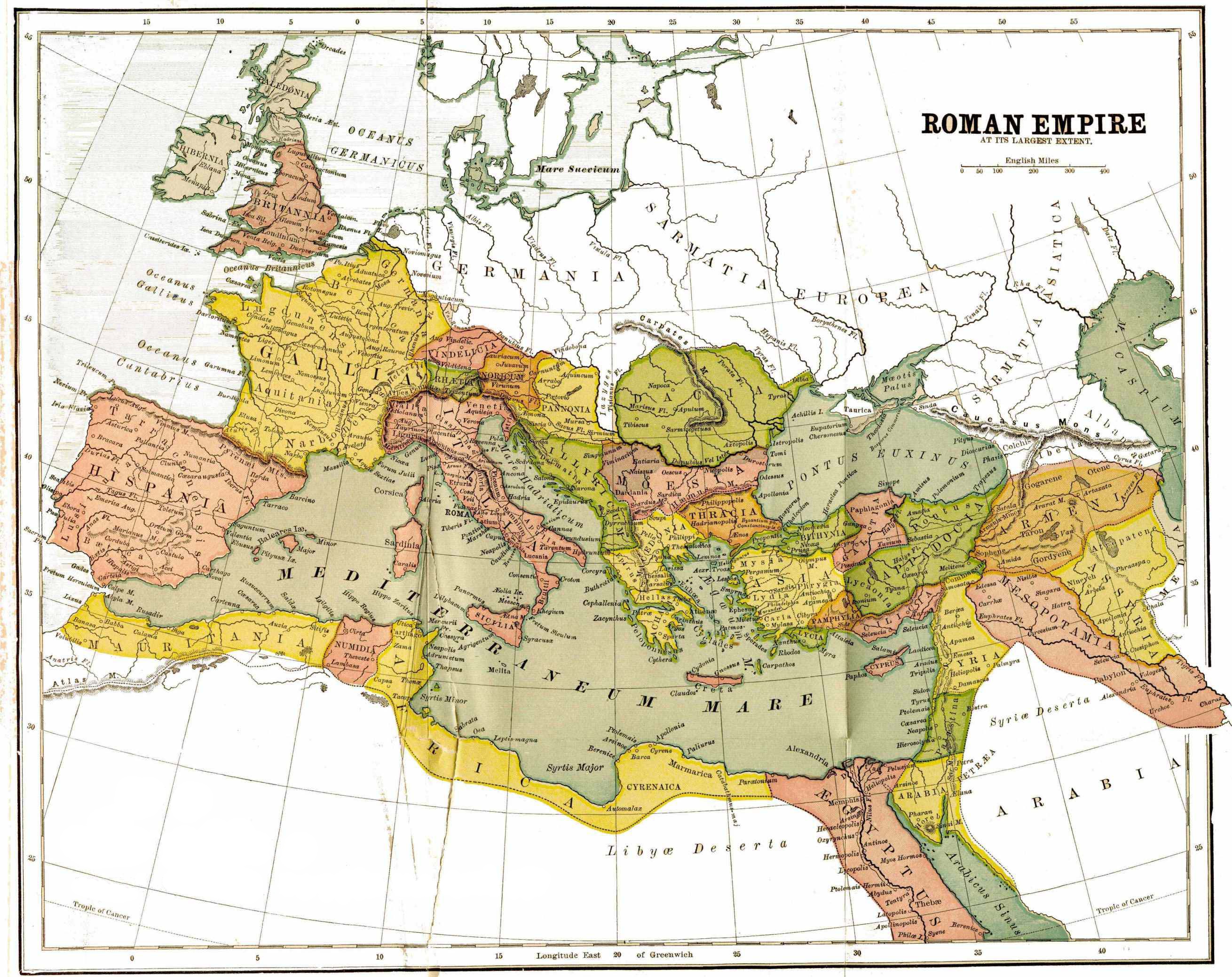
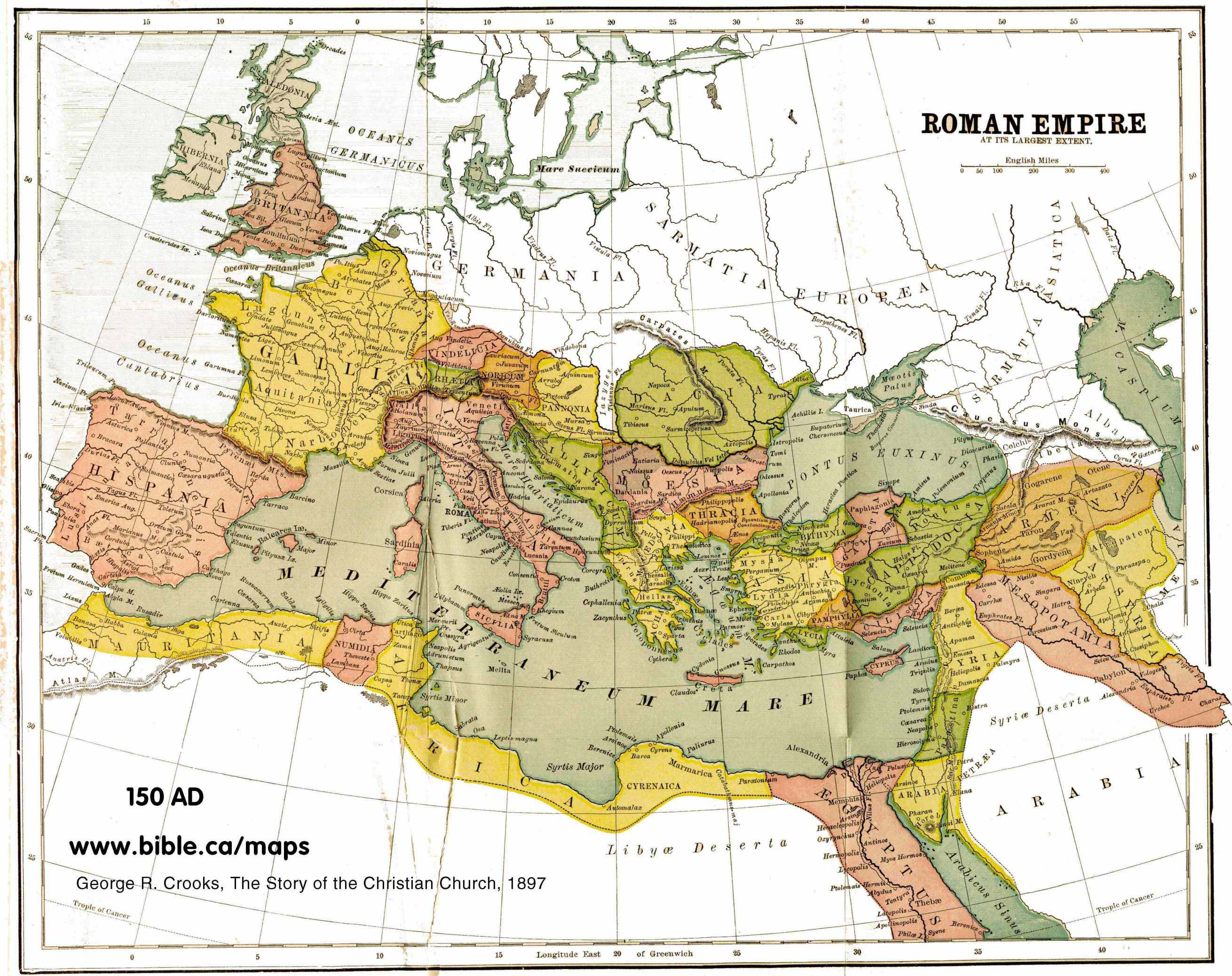
English: map of the Roman Empire, with provinces, in 150 AD |
| Daatum | |
| Quejn | http://www.bible.ca/maps/maps-roman-empire-peak-150AD.jpg |
| Urhéwer | George R. Crooks |
Lizenz
|
Des Buidl oda de Mediendatei is gmoafrei, wei dii urhebarechtliche Schutzfrist obgelaffa is. Des guilt fir ålle Staatn mit a gsetzlichn Schutzfrist vo 70 Jåhr oda weniga nachm Tod vom Urheba.
| |
| Es wurde festgestellt, dass diese Datei frei von bekannten Beschränkungen durch das Urheberrecht ist, alle verbundenen und verwandten Rechte eingeschlossen. | |
Dateiversiona
Wensd auf an Zeitpunkt klickst, nacha konst a friaane Version lodn.
| Version vom | Vorschaubuidl | Dimensióna | Nutzer | Kommentar | |
|---|---|---|---|---|---|
| aktuell | 21:50, 12. Few. 2012 | | 2.620 × 2.076 (1,12 MB) | Quibik | Removed the watermark. |
| 21:35, 21. Aug. 2010 |  | 2.620 × 2.076 (823 KB) | Ratzer | {{Information |Description={{en|1=map of the Roman Empire, with provinces, in 150 AD}} |Source=http://www.bible.ca/maps/maps-roman-empire-peak-150AD.jpg |Author=George R. Crooks |Date=1897 |Permission= |other_versions= }} [[Category:Maps of the Roman Emp |
Dateivawendung
Seitn wo de Datei nutzn:
Globale Dateinutzung
D'noochéfóiganden åndern Wikis vawénden dé Datei:
- Vawendung af af.wikipedia.org
- Vawendung af ast.wikipedia.org
- Vawendung af ba.wikipedia.org
- Vawendung af en.wikipedia.org
- Vawendung af hu.wikipedia.org
- Vawendung af incubator.wikimedia.org
- Vawendung af it.wikipedia.org
- Vawendung af lez.wikipedia.org
- Vawendung af nl.wikipedia.org
- Vawendung af pt.wikipedia.org
- Vawendung af ru.wikipedia.org