Datei:Moscow satellite image.jpeg

Seiteninhalte werden in anderen Sprachen nicht unterstützt.
Aus Wikipedia

Version in hechara Auflesung(1.000 × 1.000 Pixel, Dateigress: 396 KB, MIME-Typ: image/jpeg)

De Datei kimpt vo Wikimedia Commons. De Beschreibung vo da Dateibschreibungsseitn wead untn ozoagt.

Bschreiwung

Bschreiwung
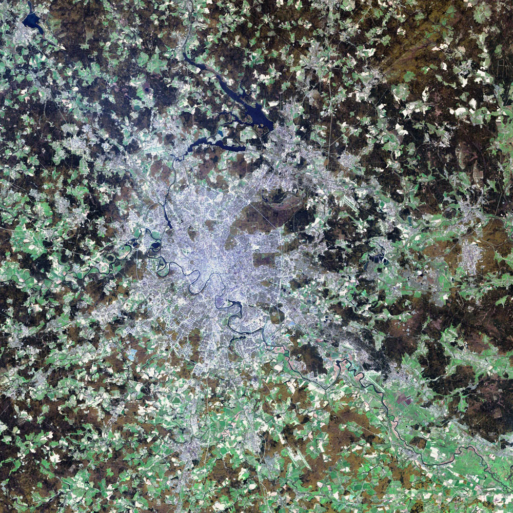
Deutsch: Satellitenbild von de:Moskau
English: satellite image of the city of en:Moscow.
Moscow, the political and economic heart of Russia, sits on the far eastern end of Europe, roughly 1300 kilometers (815 miles) west of the Ural Mountains and the Asian continent. The city boasts a population of over ten million and encompasses an area of 1035 square kilometers (405 square miles). The Moscow River runs through the center of the city, and the Kremlin, the seat of the Russian government, lies in the direct center.
Moscow is thought to have been founded in the 12th Century by Yury Dolgoruky, Prince of Suzdal, who hosted a big feast on the site. The city was shortly after established as a trading route along the Moscow River. Ivan III, who is largely credited with uniting all of Russia, built the Kremlin’s cathedrals and declared Moscow the capital of his new kingdom in the 15th century. In the 17th century, Ivan the Great moved the capital to St. Petersburg, where it remained until the Bolsheviks brought the seat of government back to Moscow in 1918. Over the years the city has been sacked and burnt to the ground by the Tartars, the Poles, and the French. Thanks to the resilient spirit of the Russian people, the city remains as vital as ever. Now it is as capitalist in nature as London or New York, and everything from Big Macs to BMWs can be found on its streets.
The blue-gray pixels in this false-color image are urban areas. The light green areas surrounding the city are farms and the brown regions are more sparsely vegetated areas. This image of Moscow was acquired by the Enhanced Thematic Mapper plus (ETM+), flying aboard the Landsat 7 satellite. July 23, 2002, marks the 30th anniversary of the Landsat program. (Click to read the press release—Celebrating 30 Years of Imaging the Earth.) The Landsat program has been particularly instrumental in tracking land use and land cover changes?such as increased urban growth?over the last three decades.
Daatum 2. August 2002
Quejn NASA Visible Earth project, http://visibleearth.nasa.gov/view_rec.php?id=3434
Urhéwer NASA/USGS EROS Data Center Satellite Systems Branch/Landsat 7/ETM+

Lizenz

Public domain
Dieses Bild ist gemeinfrei (public domain), weil es Materialien beeinhaltet, die ursprünglich vom United States Geological Survey, einer Behörde des Innenministeriums der Vereinigten Staaten, stammen. Weitere Informationen finden Sie in den Urheberrechtsbestimmungen des USGS

Bahasa Indonesia  català  čeština  Deutsch  eesti  English  español  français  galego  italiano  Nederlands  português  polski  sicilianu  suomi  Tiếng Việt  Türkçe  български  македонски  русский  മലയാളം  한국어  日本語  中文  中文(简体)  中文(繁體)  العربية  فارسی  +/−

Public domain De Datai is gmoafrai (public domain), wais vo da NASA erstöid worn is. In da NASA-Urheewerrechtsrichtlinie steet, dass as „NASA-Materiaal ned durch Urheewerrecht gschytzt is, wånns ned ånders ågeem is“. (NASA-Urheewerrechtsrichtlinie-Saiten oder JPL Image Use Policy).
Warnung:
  • De Vawendung vo NASA-Logos, Woppm und Symboie is durchs US-Gsetz 14 CFR 1221 aigschränkt.
  • D' NASA-Homepage hostet an hauffm Büider vo da Sowjetischen bzw. Russischen Raumfortsagentur sowia ånderne ned-amerikanischer Raumfortagenturn. De Büider san ned gmoafrai.
  • Materiaal vom Hubble-Wöidraumteleskop kå urheewerrechtlich gschytzt sai, wånns ned ausdrycklich vom STScI is. [1]
  • Jeeglichs Materiaal vom Solar and Heliospheric Observatory (SOHO) is urheewerrechtlich gschytzt und ma braucht a gsonderde Geneemigung fyr kommerziöie, ned-pädagogische Zwecke. [2]
  • Büider, de ois Astronomii-Büid vom Tog (APOD) vaeffmtlicht wern, san unter Umständ urheewerrechtlich gschytzt. [3]

Kurzbeschreibungen

Ergänze eine einzeilige Erklärung, was diese Datei darstellt.

In dieser Datei abgebildete Objekte

Motiv Deutsch

Dateiversiona

Wensd auf an Zeitpunkt klickst, nacha konst a friaane Version lodn.

Version vomVorschaubuidlDimensiónaNutzerKommentar
aktuell07:12, 8. Nóv. 2004Vuaschaubuid fiad Version vom 07:12, 8. Nóv. 2004, 07:12 Uhr1.000 × 1.000 (396 KB)Ævar Arnfjörð Bjarmason

Seitn wo de Datei nutzn:

Globale Dateinutzung

D'noochéfóiganden åndern Wikis vawénden dé Datei:

Metadaten