
Datei:Sahara dust plume Nov 1998.jpg

Gress dea Voaschau: 800 × 567 Pixel Weitere Auflésungan: 320 × 227 Pixel | 640 × 454 Pixel | 1.024 × 726 Pixel | 1.280 × 908 Pixel | 2.560 × 1.816 Pixel | 4.449 × 3.156 Pixel.
Version in hechara Auflesung (4.449 × 3.156 Pixel, Dateigress: 5,06 MB, MIME-Typ: image/jpeg)
Bschreiwung
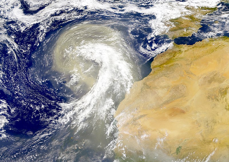
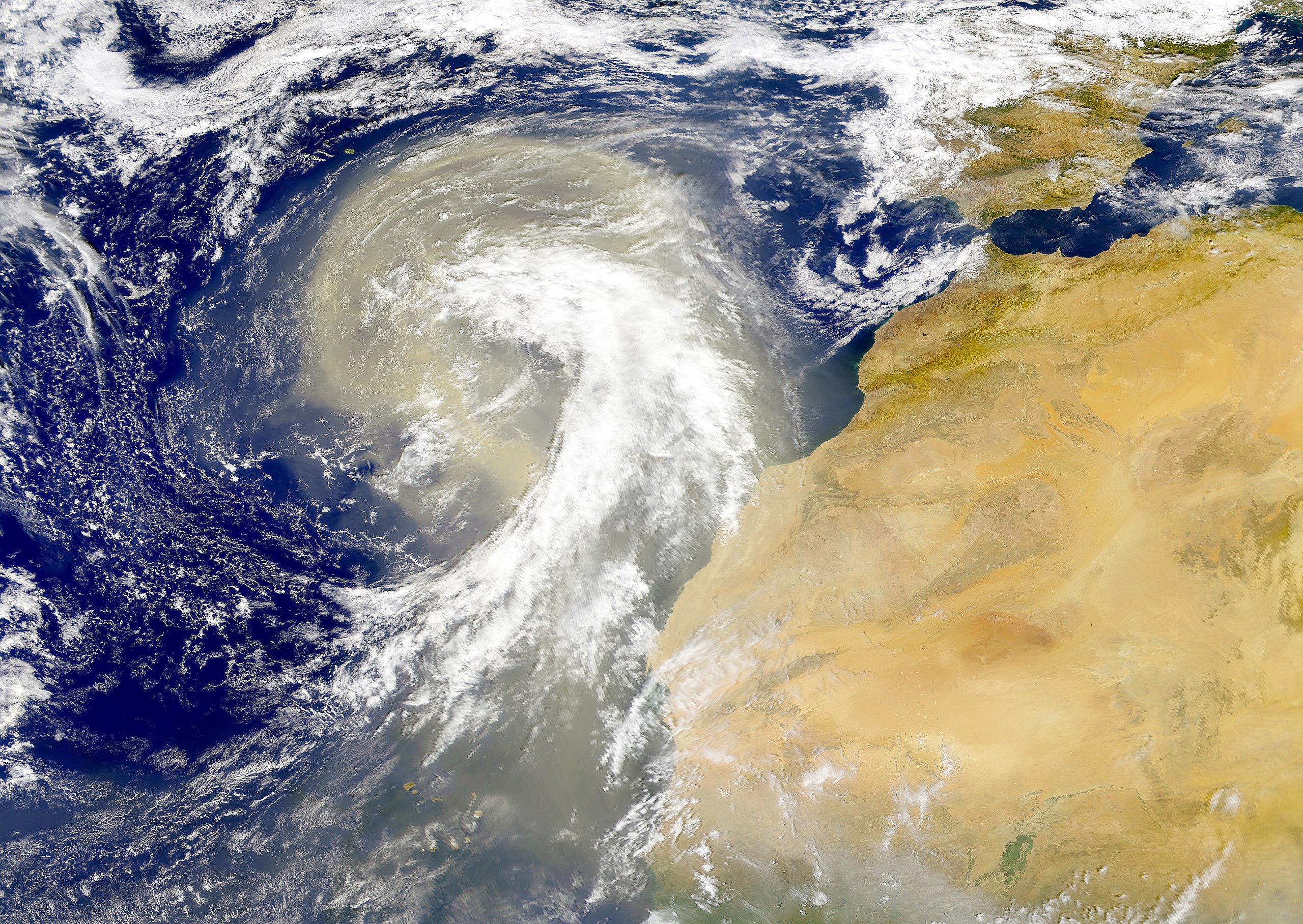
| Bschreiwung | Dust plume off the Sahara desert over the northeast Atlantic Ocean. The Azores are visible at the northwest edge of the dust plume in this SeaWiFS image. The Cape Verde Islands can be seen through the dust near the bottom of the image. Sensor: OrbView-2/SeaWiFS |
| Daatum | |
| Quejn | NASA Visible Earth |
| Urhéwer | Provided by the SeaWiFS Project, NASA/Goddard Space Flight Center, and ORBIMAGE |
Lizenz
| This image is from the Sea-viewing Wide Field-of-view Sensor (SeaWiFS) Project and more than 5 years old.
Satellite data captured by the SeaWIFS sensor are released into the public domain 5 years after capture. Data less than five years old can be re-used only for educational or scientific purposes; any commercial use of such images must be coordinated with GeoEye. [1] |
| This work has been released into the public domain by its copyright holder, GeoEye. This applies worldwide. In manchen Staaten könnte dies rechtlich nicht möglich sein. Sofern dies der Fall ist: GeoEye gewährt jedem das bedingungslose Recht, dieses Werk für jedweden Zweck zu nutzen, es sei denn, Bedingungen sind gesetzlich erforderlich.
|
Dateiversiona
Wensd auf an Zeitpunkt klickst, nacha konst a friaane Version lodn.
| Version vom | Vorschaubuidl | Dimensióna | Nutzer | Kommentar | |
|---|---|---|---|---|---|
| aktuell | 02:01, 6. Nóv. 2005 | | 4.449 × 3.156 (5,06 MB) | Tintazul | {{Information| |Description=Dust plume off the Sahara desert over the northeast Atlantic Ocean. The Azores are visible at the northwest edge of the dust plume in this SeaWiFS image. The Cape Verde Islands can be seen through the dust near the bottom of th |
Dateivawendung
Seitn wo de Datei nutzn:
Globale Dateinutzung
D'noochéfóiganden åndern Wikis vawénden dé Datei:
- Vawendung af ar.wikipedia.org
- Vawendung af ast.wikipedia.org
- Vawendung af azb.wikipedia.org
- Vawendung af ca.wikipedia.org
- Vawendung af en.wikipedia.org
- Vawendung af en.wikivoyage.org
- Vawendung af eo.wikipedia.org
- Vawendung af es.wikipedia.org
- Vawendung af fa.wikipedia.org
- Vawendung af ga.wikipedia.org
- Vawendung af hu.wikipedia.org
- Vawendung af ko.wikipedia.org
- Vawendung af lt.wikipedia.org
- Vawendung af lv.wikipedia.org
- Vawendung af ml.wikipedia.org
- Vawendung af uk.wikipedia.org
- Vawendung af vi.wikipedia.org
- Vawendung af www.wikidata.org