
Datei:Yemen districts.png

Gress dea Voaschau: 800 × 513 Pixel Weitere Auflésungan: 320 × 205 Pixel | 640 × 411 Pixel | 1.024 × 657 Pixel | 1.280 × 821 Pixel | 1.601 × 1.027 Pixel.
Version in hechara Auflesung (1.601 × 1.027 Pixel, Dateigress: 46 KB, MIME-Typ: image/png)
Bschreiwung
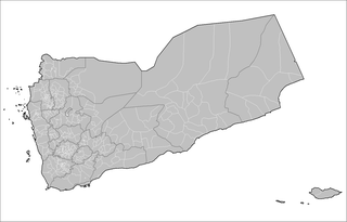
| Bschreiwung | Map of the districts of Yemen. Created by Rarelibra 23:01, 15 November 2007 (UTC) for public domain use, using MapInfo Professional v8.5 and various mapping resources. |
| Daatum | 15. Nóvémber 2007 (Original-Hochladedatum) |
| Quejn | Die Autorenschaft wurde nicht in einer maschinell lesbaren Form angegeben. Es wird angenommen, dass es sich um ein eigenes Werk handelt (basierend auf den Rechteinhaber-Angaben). |
| Urhéwer | Die Autorenschaft wurde nicht in einer maschinell lesbaren Form angegeben. Es wird Rarelibra als Autor angenommen (basierend auf den Rechteinhaber-Angaben). |
Lizenz
| Ich, der Urheberrechtsinhaber dieses Werkes, veröffentliche es als gemeinfrei. Dies gilt weltweit. In manchen Staaten könnte dies rechtlich nicht möglich sein. Sofern dies der Fall ist: Ich gewähre jedem das bedingungslose Recht, dieses Werk für jedweden Zweck zu nutzen, es sei denn, Bedingungen sind gesetzlich erforderlich. |
Dateiversiona
Wensd auf an Zeitpunkt klickst, nacha konst a friaane Version lodn.
| Version vom | Vorschaubuidl | Dimensióna | Nutzer | Kommentar | |
|---|---|---|---|---|---|
| aktuell | 17:03, 16. Nóv. 2007 | | 1.601 × 1.027 (46 KB) | Rarelibra | Updated districts |
| 01:07, 16. Nóv. 2007 |  | 1.601 × 1.027 (39 KB) | Rarelibra | Correct with center on islands as well | |
| 01:01, 16. Nóv. 2007 |  | 1.601 × 1.027 (42 KB) | Rarelibra | Map of the districts of Yemen. Created by ~~~~ for public domain use, using MapInfo Professional v8.5 and various mapping resources. |
Dateivawendung
Seitn wo de Datei nutzn:
Globale Dateinutzung
D'noochéfóiganden åndern Wikis vawénden dé Datei:
- Vawendung af ar.wikipedia.org
- Vawendung af de.wikipedia.org
- Vawendung af el.wikipedia.org
- Vawendung af en.wikipedia.org
- Vawendung af fa.wikipedia.org
- Vawendung af it.wikipedia.org
- Vawendung af nn.wikipedia.org
- Vawendung af tr.wikipedia.org
- Vawendung af ur.wikipedia.org
- Vawendung af zh-min-nan.wikipedia.org