Dyer Island, Rhode Island
| Dyer Island | ||
|---|---|---|
| Gwassa | Narragansett Bay, Atlantischa Ozean | |
| Geographische Log | 41° 34′ 57″ N, 71° 17′ 58″ W | |
|
| ||
| Leng | 600 m | |
| Broadn | 200 m | |
| Flechn | 12 ha | |
| Eiwohna | (unbewohnt) | |
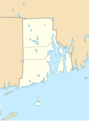
Dyer Island is a kloane Insl in da Narragansett Bay im US-Bundesstoot Rhode Island.
Se liegd oan Kilometa voa da Westgstod vo da Insl Rhode Island und is Tei van Ort Melville, wejcha za da Stod Portsmouth ghead.
Dyer Island is unbwohnd und hod a Landfläch vo uma 12 Hektar. 1300 Meta westli liegd Prudence Island.
Weblinks[Werkeln | Am Gwëntext werkeln]
- Dyer Island im Geographic Names Information System vom United States Geological Survey
- Dyer Island: Block 9021, Census Tract 401.03, Newport County, Rhode Island United States Census Bureau

