
Datei:Tahoua Region departments.png

Version in hechara Auflesung (1.056 × 816 Pixel, Dateigress: 24 KB, MIME-Typ: image/png)
| Bschreiwung |
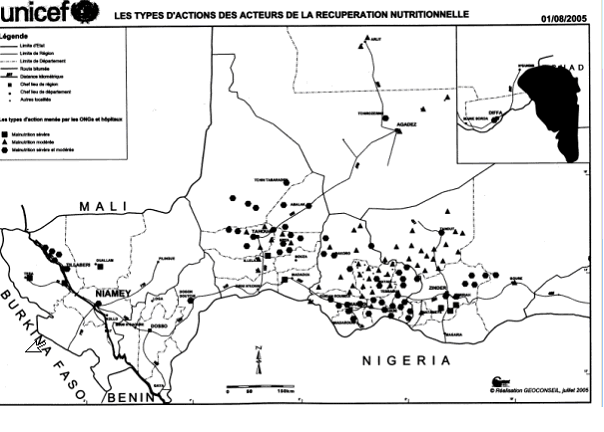
SummaryMap of the Departments of Tahoua Region, following the changes in administrative naming 1999-2005, with the addition of Abalak Department: a new subdivision created from the Tchin-tabaraden Department. Derived from Map of the arrondissements of Tahoua department in Niger. Created by Rarelibra 18:37, 13 September 2006 (UTC) for public domain use, using MapInfo Professional v8.5 and various mapping resources. See: fr:Tahoua (région) and en:Departments of Niger Image:Tahoua arrondissements.png http://www.senat.fr/rap/r04-512/r04-5128.gif Unicef Map http://www.fao.org/ag/agl/agll/wocat/wqasum.asp?questid=NIG05 FAO report http://www.fao.org/ag/agl/agll/wocat/img/qtnig7d.jpg FAO Map http://fr.wikipedia.org/wiki/Tahoua_%28r%C3%A9gion%29 Tahoua (région) * Département de Abalak Superficie: 77 445 km² (1) Population: 80 777 hts Centre urbaine: Ville d'Abalak |
| Daatum | (UTC) |
| Quejn | |
| Urhéwer |
|
| Aundre Versióner |
|

| Dieses Bild wurde digital nachbearbeitet. Folgende Änderungen wurden vorgenommen: added subdivision. Das Originalbild kann hier eingesehen werden: Tahoua arrondissements.png: File:Tahoua arrondissements.png. Bearbeitet von T L Miles.
|
| Ich, der Urheberrechtsinhaber dieses Werkes, veröffentliche es als gemeinfrei. Dies gilt weltweit. In manchen Staaten könnte dies rechtlich nicht möglich sein. Sofern dies der Fall ist: Ich gewähre jedem das bedingungslose Recht, dieses Werk für jedweden Zweck zu nutzen, es sei denn, Bedingungen sind gesetzlich erforderlich. |
Ursprüngliches Datei-Logbuch
This image is a derivative work of the following images:
- Image:Tahoua_arrondissements.png licensed with PD-self
- 2006-11-10T12:48:31Z Béka 1056x816 (23579 Bytes) {{Information| |Description= == Summary == Map of the arrondissements of Tahoua department in Niger. Created by [[:en:User:Rarelibra|Rarelibra]] 18:37, 13 September 2006 (UTC) for public domain use, using MapInfo Professional
Hochgeladen mit derivativeFX
Dateiversiona
Wensd auf an Zeitpunkt klickst, nacha konst a friaane Version lodn.
| Version vom | Vorschaubuidl | Dimensióna | Nutzer | Kommentar | |
|---|---|---|---|---|---|
| aktuell | 20:48, 19. Jun. 2008 | | 1.056 × 816 (24 KB) | T L Miles | {{Information |Description=== Summary == Map of the Departments of Tahoua Region, following the changes in administrative naming 1999-2005, with the addition of Abalak Department: a new subdivision created from the Tchin-tabaraden Department. Derived f |
Dateivawendung
Seitn wo de Datei nutzn:
Globale Dateinutzung
D'noochéfóiganden åndern Wikis vawénden dé Datei:
- Vawendung af da.wikipedia.org
- Vawendung af de.wikipedia.org
- Vawendung af en.wikipedia.org
- Vawendung af es.wikipedia.org
- Vawendung af fr.wikipedia.org
- Vawendung af ha.wikipedia.org
- Vawendung af ja.wikipedia.org
- Vawendung af lv.wikipedia.org
- Vawendung af pt.wikipedia.org
- Vawendung af ro.wikipedia.org
- Vawendung af ru.wikipedia.org
- Vawendung af tr.wikipedia.org
- Vawendung af ur.wikipedia.org
- Vawendung af www.wikidata.org
Weitere globale Verwendungen dieser Datei anschauen.