
Datei:Karte Chiemgau.png

Gress dea Voaschau: 691 × 600 Pixel Weitere Auflésungan: 277 × 240 Pixel | 553 × 480 Pixel | 885 × 768 Pixel | 1.180 × 1.024 Pixel | 2.155 × 1.870 Pixel.
Version in hechara Auflesung (2.155 × 1.870 Pixel, Dateigress: 1,33 MB, MIME-Typ: image/png)
| Bschreiwung |
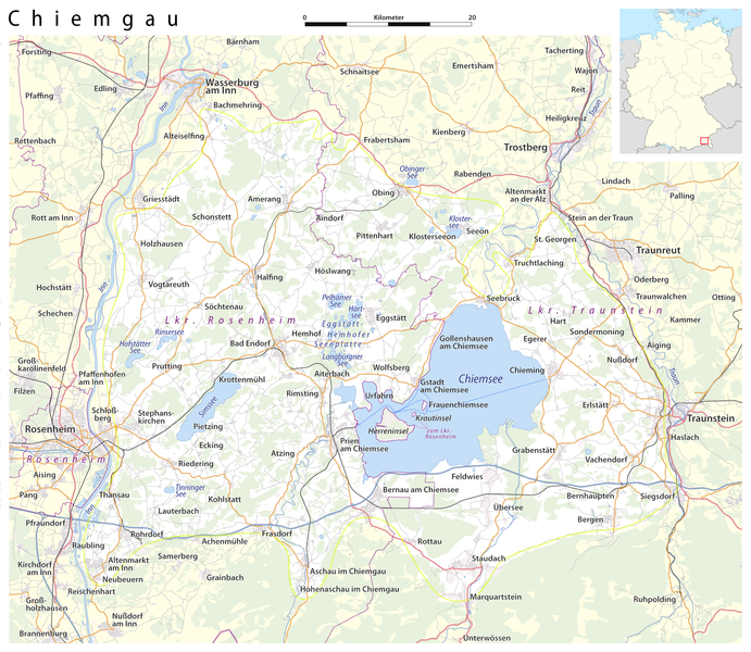
Deutsch: Karte: Chiemgau (Abgrenzung nach BfN)
English: Map: Chiemgau |
| Daatum | see file history |
| Quejn |
own work, using
|
| Urhéwer | Maximilian Dörrbecker (Chumwa) |
| Gnémigung (Weidernutzung voh derer Daatei) |
All OpenStreetMap data and maps are Creative Commons "CC-BY-SA 2.0" licensed Diese Datei ist unter der Creative-Commons-Lizenz „Namensnennung – Weitergabe unter gleichen Bedingungen 2.0 generisch“ (US-amerikanisch) lizenziert.
|
Dateiversiona
Wensd auf an Zeitpunkt klickst, nacha konst a friaane Version lodn.
| Version vom | Vorschaubuidl | Dimensióna | Nutzer | Kommentar | |
|---|---|---|---|---|---|
| aktuell | 02:02, 5. Jun. 2015 | | 2.155 × 1.870 (1,33 MB) | Cmdrjameson | Compressed with pngout. Reduced by 829kB (37% decrease). |
| 23:58, 6. Nóv. 2009 |  | 2.155 × 1.870 (2,14 MB) | Chumwa | Hemhofer Seenplatte → Eggstätt-Hemhofer Seenplatte | |
| 23:15, 4. Nóv. 2009 |  | 2.155 × 1.870 (2,14 MB) | Chumwa | Chiemseeinseln gehören zum Lkr. Rosenheim | |
| 08:51, 4. Nóv. 2009 |  | 2.155 × 1.870 (2,14 MB) | Chumwa | {{Information |Description={{de|Karte: Chiemgau}} {{en|Map: Chiemgau}} |Author=Maximilian Dörrbecker (Chumwa) |Source=own work, using * OpenStreetMap data for the background * [[:File:Germany_location_map.svg|t |
Dateivawendung
Seitn wo de Datei nutzn:
Globale Dateinutzung
D'noochéfóiganden åndern Wikis vawénden dé Datei:
- Vawendung af an.wikipedia.org
- Vawendung af ar.wikipedia.org
- Vawendung af arz.wikipedia.org
- Vawendung af ca.wikipedia.org
- Vawendung af ceb.wikipedia.org
- Vawendung af de.wikipedia.org
- Vawendung af de.wikivoyage.org
- Vawendung af en.wikipedia.org
- Vawendung af eo.wikipedia.org
- Vawendung af es.wikipedia.org
- Vawendung af eu.wikipedia.org
- Vawendung af fr.wikipedia.org
- Vawendung af hu.wikipedia.org
- Vawendung af it.wikipedia.org
- Vawendung af nl.wikipedia.org
- Vawendung af pl.wikipedia.org
- Vawendung af pl.wikivoyage.org
- Vawendung af ro.wikipedia.org
- Vawendung af ru.wikipedia.org
- Vawendung af sr.wikipedia.org
- Vawendung af www.wikidata.org