
Datei:Canada Manitoba location map.svg

Größe der PNG-Vorschau dieser SVG-Datei: 486 × 599 Pixel. Weitere Auflésungan: 195 × 240 Pixel | 389 × 480 Pixel | 623 × 768 Pixel | 831 × 1.024 Pixel | 1.661 × 2.048 Pixel | 1.512 × 1.864 Pixel.
Version in hechara Auflesung (SVG-Datei, Basisgress: 1.512 × 1.864 Pixl, Dateigress: 809 KB)
Bschreiwung
| Bschreiwung |
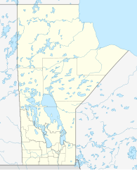
Quadratische Plattkarte, N-S-Streckung 170 %. Geographische Begrenzung der Karte:
Equirectangular projection, N/S stretching 170 %. Geographic limits of the map:
|
| Daatum | |
| Quejn |
Eigenes Werk, using
|
| Urhéwer | NordNordWest |
| Gnémigung (Weidernutzung voh derer Daatei) |
Diese Datei ist unter der Creative-Commons-Lizenz „Namensnennung – Weitergabe unter gleichen Bedingungen 3.0 nicht portiert“ lizenziert.
|
| Aundre Versióner |
Derivative works of this file:
|


|
Diese Karte wurde in der Kartenwerkstatt erstellt oder verbessert. Auch du kannst dort Karten vorschlagen, die zu erstellen, verändern oder übersetzen sind.
|
Dateiversiona
Wensd auf an Zeitpunkt klickst, nacha konst a friaane Version lodn.
| Version vom | Vorschaubuidl | Dimensióna | Nutzer | Kommentar | |
|---|---|---|---|---|---|
| aktuell | 13:57, 28. Aug. 2009 | | 1.512 × 1.864 (809 KB) | NordNordWest | {{int:filedesc}} {{Information |Description= {{de|Positionskarte von Manitoba, Kanada}} Quadratische Plattkarte, N-S-Streckung 170 %. Geographische Begrenzung der Karte: * N: 60.3° N * S: 48.7° N * W: 104.0° W * O: 88.0� |
Dateivawendung
Seitn wo de Datei nutzn:
Globale Dateinutzung
D'noochéfóiganden åndern Wikis vawénden dé Datei:
- Vawendung af ar.wikipedia.org
- Vawendung af ba.wikipedia.org
- Vawendung af ca.wikipedia.org
- Vawendung af cs.wikipedia.org
- Vawendung af de.wikipedia.org
- Winnipeg
- Eishockey-Weltmeisterschaft der U20-Junioren 1999
- Churchill (Manitoba)
- Canada Life Centre
- Winnipegosis (Manitoba)
- Winkler (Manitoba)
- Altona (Manitoba)
- Reykjavik (Manitoba)
- Thompson (Manitoba)
- Arborg (Manitoba)
- Ashern (Manitoba)
- Steinbach (Manitoba)
- Dauphin (Manitoba)
- Selkirk (Manitoba)
- Gimli (Manitoba)
- Brandon (Manitoba)
- Lower Fort Garry
- Vorlage:Positionskarte Kanada Manitoba
- St. François Xavier
- Morden (Manitoba)
- Beausejour
- Grand Rapids (Manitoba)
- Portage la Prairie
- Carberry
- Minnedosa
- Wikipedia:Kartenwerkstatt/Positionskarten/Nordamerika
- York Factory (Manitoba)
- Norway House
- Painted Stone Portage
- Saint-Boniface (Manitoba)
- Flin Flon Airport
- Fort Prince of Wales
- Winnipeg Arena
- Winnipeg Beach
- Boissevain (Manitoba)
- Polo Park
- Emerson (Manitoba)
- Swan River (Manitoba)
- IG Field
- 201 Portage
Weitere globale Verwendungen dieser Datei anschauen.