
Datei:Czech Republic districts.png
Gress dea Voaschau: 800 × 540 Pixel Weitere Auflésungan: 320 × 216 Pixel | 640 × 432 Pixel | 1.024 × 692 Pixel | 1.300 × 878 Pixel.
Version in hechara Auflesung (1.300 × 878 Pixel, Dateigress: 42 KB, MIME-Typ: image/png)
Bschreiwung
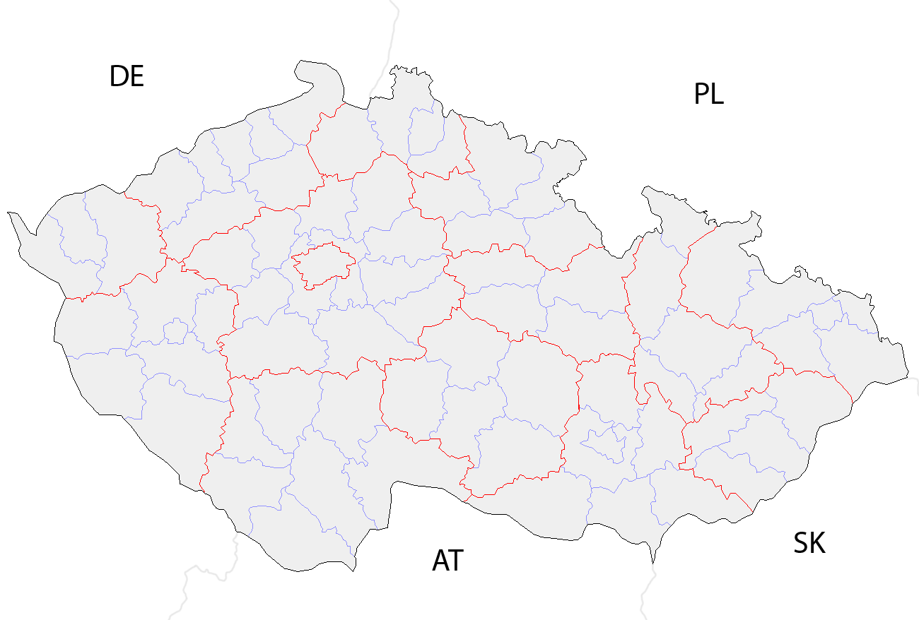
| Bschreiwung | Map of the districts of the Czech Republic showing former district borders before December 31, 2006. Created by Rarelibra 18:42, 29 December 2006 (UTC) for public domain use, using MapInfo Professional v8.5 and various mapping resources. |
| Daatum | 29. Dezémber 2006 (Original-Hochladedatum) |
| Quejn | Die Autorenschaft wurde nicht in einer maschinell lesbaren Form angegeben. Es wird angenommen, dass es sich um ein eigenes Werk handelt (basierend auf den Rechteinhaber-Angaben). |
| Urhéwer | Die Autorenschaft wurde nicht in einer maschinell lesbaren Form angegeben. Es wird Rarelibra als Autor angenommen (basierend auf den Rechteinhaber-Angaben). |
Lizenz
| Ich, der Urheberrechtsinhaber dieses Werkes, veröffentliche es als gemeinfrei. Dies gilt weltweit. In manchen Staaten könnte dies rechtlich nicht möglich sein. Sofern dies der Fall ist: Ich gewähre jedem das bedingungslose Recht, dieses Werk für jedweden Zweck zu nutzen, es sei denn, Bedingungen sind gesetzlich erforderlich. |
Dateiversiona
Wensd auf an Zeitpunkt klickst, nacha konst a friaane Version lodn.
| Version vom | Vorschaubuidl | Dimensióna | Nutzer | Kommentar | |
|---|---|---|---|---|---|
| aktuell | 12:14, 2. Ókt. 2008 | | 1.300 × 878 (42 KB) | Happenstance | rv myself |
| 12:05, 2. Ókt. 2008 |  | 1.300 × 878 (42 KB) | Happenstance | lightening country codes | |
| 12:02, 2. Ókt. 2008 |  | 1.300 × 878 (42 KB) | Happenstance | added transparency, foreign borders and country codes, separated borders between okresy and borders between kraje | |
| 20:42, 29. Dez. 2006 |  | 1.281 × 878 (30 KB) | Rarelibra | Map of the districts of the Czech Republic. Created by ~~~~ for public domain use, using MapInfo Professional v8.5 and various mapping resources. |
Dateivawendung
Koa Seitn nutzt de Datei.
Globale Dateinutzung
D'noochéfóiganden åndern Wikis vawénden dé Datei:
- Vawendung af br.wikipedia.org
- Vawendung af da.wikipedia.org
- Vawendung af en.wikipedia.org
- Vawendung af eo.wikipedia.org
- Vawendung af es.wikipedia.org
- Vawendung af fa.wikipedia.org
- Vawendung af gl.wikipedia.org
- Vawendung af hu.wikipedia.org
- Vawendung af it.wikipedia.org
- Vawendung af ko.wikipedia.org
- Vawendung af la.wikipedia.org
- Vawendung af lmo.wikipedia.org
- Vawendung af ms.wikipedia.org
- Vawendung af nl.wikipedia.org
- Vawendung af or.wikipedia.org
- Vawendung af pa.wikipedia.org
- Vawendung af pl.wikipedia.org
- Vawendung af pnb.wikipedia.org
- Vawendung af pt.wikipedia.org
- Vawendung af ro.wikipedia.org
- Vawendung af sh.wikipedia.org
- Vawendung af sq.wikipedia.org
- Vawendung af sv.wikipedia.org
- Vawendung af tr.wikipedia.org
- Vawendung af uk.wikipedia.org
- Vawendung af ur.wikipedia.org
- Vawendung af vi.wikipedia.org
- Vawendung af zh.wikipedia.org