
Datei:Dominican Republic location map.svg

Größe der PNG-Vorschau dieser SVG-Datei: 737 × 600 Pixel. Weitere Auflésungan: 295 × 240 Pixel | 590 × 480 Pixel | 944 × 768 Pixel | 1.259 × 1.024 Pixel | 2.517 × 2.048 Pixel | 1.400 × 1.139 Pixel.
Version in hechara Auflesung (SVG-Datei, Basisgress: 1.400 × 1.139 Pixl, Dateigress: 182 KB)
queretaro
Bschreiwung
| Bschreiwung |
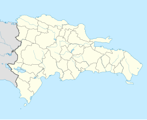
Deutsch: Positionskarte Dominikanische Republik mit Provinzen, Quadratische Plattkarte, N-S-Streckung 105 %. Geographische Begrenzung der Karte:
English: Location map Dominican Republic with Provinces, Equirectangular projection, N/S stretching 105 %. Geographic limits of the map:
|
||
| Daatum | |||
| Quejn |
Eigenes Werk,VMAP0, http://www.one.gob.do, http://lib.utexas.edu/maps/dominican_republic.html
|
||
| Urhéwer | Alexrk2 | ||
| Aundre Versióner |
|
||
| SVG‑Erstellung |
|


Lizenz
Diese Datei ist unter der Creative-Commons-Lizenz „Namensnennung – Weitergabe unter gleichen Bedingungen 3.0 nicht portiert“ lizenziert.
- Dieses Werk darf von dir
- vabroatt wern – vafüfötigt, vabroatt und éffantlich zuegénglich gmocht wern.
- neu zusammengestellt werden – abgewandelt und bearbeitet werden
- Zu den folgenden Bedingungen:
- Nåmansnénnung – Du musst angemessene Urheber- und Rechteangaben machen, einen Link zur Lizenz beifügen und angeben, ob Änderungen vorgenommen wurden. Diese Angaben dürfen in jeder angemessenen Art und Weise gemacht werden, allerdings nicht so, dass der Eindruck entsteht, der Lizenzgeber unterstütze gerade dich oder deine Nutzung besonders.
- Weidergob unter gleiche Bedingungan – Wenn du das Material wiedermischst, transformierst oder darauf aufbaust, musst du deine Beiträge unter der gleichen oder einer kompatiblen Lizenz wie das Original verbreiten.
Dateiversiona
Wensd auf an Zeitpunkt klickst, nacha konst a friaane Version lodn.
| Version vom | Vorschaubuidl | Dimensióna | Nutzer | Kommentar | |
|---|---|---|---|---|---|
| aktuell | 20:39, 10. Few. 2010 | | 1.400 × 1.139 (182 KB) | Alexrk2 | fixed boundary style |
| 15:17, 7. Few. 2010 |  | 1.400 × 1.139 (181 KB) | Alexrk2 | == Summary == {{Information |Description= {{de|Positionskarte Dominikanische Republik mit Provinzen, Quadratische Plattkarte, N-S-Streckung 105 %. Geographische Begrenzung der Karte:}} {{en|Location map [[:en:Dominican Repu |
Dateivawendung
Seitn wo de Datei nutzn:
Globale Dateinutzung
D'noochéfóiganden åndern Wikis vawénden dé Datei:
- Vawendung af af.wikipedia.org
- Vawendung af an.wikipedia.org
- Vawendung af ar.wikipedia.org
- Vawendung af ast.wikipedia.org
- La Barraquera (San José de Ocoa)
- Oviedo (República Dominicana)
- Santu Domingu
- Módulu:Mapa de llocalización/datos/República Dominicana
- Bancu Central de la República Dominicana
- Módulu:Mapa de llocalización/datos/República Dominicana/usu
- Copa Panamericana de Voleibol Femenín de 2018
- Aeródromu de Cabo Rojo
- Aeropuertu Domésticu de Constanza
- Aeropuertu Osvaldo Virgil
- Aeródromu de Portillo
- Puertu de Puerto Plata
- Puertu de San Pedro de Macorís
- Puertu de Santu Domingu
- Ríu Ozama
- Vawendung af az.wikipedia.org
- Vawendung af ba.wikipedia.org
- Vawendung af be-tarask.wikipedia.org
- Vawendung af be.wikipedia.org
- Vawendung af bg.wikipedia.org
- Vawendung af bn.wikipedia.org
- Vawendung af bs.wikipedia.org
- Vawendung af ca.wikipedia.org
- Vawendung af ceb.wikipedia.org
Weitere globale Verwendungen dieser Datei anschauen.