
Datei:Morocco relief location map.jpg

Gress dea Voaschau: 737 × 600 Pixel Weitere Auflésungan: 295 × 240 Pixel | 590 × 480 Pixel | 944 × 768 Pixel | 1.223 × 995 Pixel.
Version in hechara Auflesung (1.223 × 995 Pixel, Dateigress: 265 KB, MIME-Typ: image/jpeg)
Bschreiwung
| Bschreiwung |
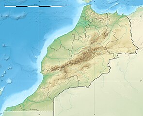
English: Blank physical map of Morocco, for geo-location purposes.
Français : Carte physique vierge du Maroc, destinée à la géolocalisation. Scale: 1:4,000,000 (precision: 1,000 m)
Geographic limits of the map:
|
||
| Daatum | 2009-11, updated 2017-02 | ||
| Quejn |
Eigenes Werk
|
||
| Urhéwer | Eric Gaba (Sting - fr:Sting) | ||
| Gnémigung (Weidernutzung voh derer Daatei) |
|
||
| Aundre Versióner |
|

| Kameraposition | | Dieses und weitere Bilder auf OpenStreetMap |
|---|
Lizenz
Diese Datei ist unter der Creative-Commons-Lizenz „Namensnennung – Weitergabe unter gleichen Bedingungen 3.0 nicht portiert“ lizenziert.
- Dieses Werk darf von dir
- vabroatt wern – vafüfötigt, vabroatt und éffantlich zuegénglich gmocht wern.
- neu zusammengestellt werden – abgewandelt und bearbeitet werden
- Zu den folgenden Bedingungen:
- Nåmansnénnung – Du musst angemessene Urheber- und Rechteangaben machen, einen Link zur Lizenz beifügen und angeben, ob Änderungen vorgenommen wurden. Diese Angaben dürfen in jeder angemessenen Art und Weise gemacht werden, allerdings nicht so, dass der Eindruck entsteht, der Lizenzgeber unterstütze gerade dich oder deine Nutzung besonders.
- Weidergob unter gleiche Bedingungan – Wenn du das Material wiedermischst, transformierst oder darauf aufbaust, musst du deine Beiträge unter der gleichen oder einer kompatiblen Lizenz wie das Original verbreiten.

|
Es ist erlaubt, die Datei unter den Bedingungen der GNU-Lizenz für freie Dokumentation, Version 1.2 oder einer späteren Version, veröffentlicht von der Free Software Foundation, zu kopieren, zu verbreiten und/oder zu modifizieren; es gibt keine unveränderlichen Abschnitte, keinen vorderen und keinen hinteren Umschlagtext.
Der vollständige Text der Lizenz ist im Kapitel GNU-Lizenz für freie Dokumentation verfügbar. |
Dateiversiona
Wensd auf an Zeitpunkt klickst, nacha konst a friaane Version lodn.
| Version vom | Vorschaubuidl | Dimensióna | Nutzer | Kommentar | |
|---|---|---|---|---|---|
| aktuell | 22:55, 10. Few. 2017 | | 1.223 × 995 (265 KB) | Sting | Updated regions borders as since 2015 |
| 15:11, 19. Jul. 2010 |  | 1.223 × 995 (234 KB) | Sting | Color profile | |
| 22:31, 21. Nóv. 2009 |  | 1.223 × 995 (240 KB) | Sting | Putting back the southern dotted boundary (regarding Western Sahara's location map) | |
| 03:23, 21. Nóv. 2009 |  | 1.223 × 995 (239 KB) | Sting | Drawback for one "correction" | |
| 03:10, 21. Nóv. 2009 |  | 1.223 × 995 (240 KB) | Sting | Several little corrections | |
| 02:09, 21. Nóv. 2009 |  | 1.223 × 995 (241 KB) | Sting | == {{int:filedesc}} == {{Location|31|46|30|N|7|04|30|W|scale:5000000}} <br/> {{Information |Description={{en|Blank physical map of Morocco, for geo-location purposes.}} {{fr|Carte physique vierge du Maroc, destinée à la gé |
Dateivawendung
Seitn wo de Datei nutzn:
Globale Dateinutzung
D'noochéfóiganden åndern Wikis vawénden dé Datei:
- Vawendung af af.wikipedia.org
- Vawendung af ar.wikipedia.org
- Vawendung af ast.wikipedia.org
- Vawendung af azb.wikipedia.org
- Vawendung af az.wikipedia.org
- Vawendung af ba.wikipedia.org
- Vawendung af be.wikipedia.org
- Vawendung af bg.wikipedia.org
Weitere globale Verwendungen dieser Datei anschauen.