
Datei:Hanoi location map.svg

Größe der PNG-Vorschau dieser SVG-Datei: 512 × 512 Pixel. Weitere Auflésungan: 240 × 240 Pixel | 480 × 480 Pixel | 768 × 768 Pixel | 1.024 × 1.024 Pixel | 2.048 × 2.048 Pixel.
Version in hechara Auflesung (SVG-Datei, Basisgress: 512 × 512 Pixl, Dateigress: 226 KB)
Bschreiwung
| Bschreiwung |
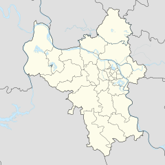
English: Location map of Hanoi |
| Daatum | |
| Quejn | Eigenes Werk |
| Urhéwer | Mai Ngọc Xuân |
| SVG‑Erstellung |
Lizenz
Diese Datei ist lizenziert unter der Creative-Commons-Lizenz „Namensnennung – Weitergabe unter gleichen Bedingungen 4.0 international“.
- Dieses Werk darf von dir
- vabroatt wern – vafüfötigt, vabroatt und éffantlich zuegénglich gmocht wern.
- neu zusammengestellt werden – abgewandelt und bearbeitet werden
- Zu den folgenden Bedingungen:
- Nåmansnénnung – Du musst angemessene Urheber- und Rechteangaben machen, einen Link zur Lizenz beifügen und angeben, ob Änderungen vorgenommen wurden. Diese Angaben dürfen in jeder angemessenen Art und Weise gemacht werden, allerdings nicht so, dass der Eindruck entsteht, der Lizenzgeber unterstütze gerade dich oder deine Nutzung besonders.
- Weidergob unter gleiche Bedingungan – Wenn du das Material wiedermischst, transformierst oder darauf aufbaust, musst du deine Beiträge unter der gleichen oder einer kompatiblen Lizenz wie das Original verbreiten.
Dateiversiona
Wensd auf an Zeitpunkt klickst, nacha konst a friaane Version lodn.
| Version vom | Vorschaubuidl | Dimensióna | Nutzer | Kommentar | |
|---|---|---|---|---|---|
| aktuell | 22:35, 1. Dez. 2022 | | 512 × 512 (226 KB) | Hakutora | add water layer |
| 06:38, 14. Aug. 2021 |  | 512 × 512 (43 KB) | Hari caaru | Adjust boundaries | |
| 15:45, 14. Ókt. 2017 |  | 512 × 512 (43 KB) | Hakutora | update | |
| 17:54, 5. Ókt. 2017 |  | 512 × 511 (139 KB) | Hakutora | User created page with UploadWizard |
Dateivawendung
Koa Seitn nutzt de Datei.
Globale Dateinutzung
D'noochéfóiganden åndern Wikis vawénden dé Datei:
- Vawendung af en.wikipedia.org
- Noi Bai International Airport
- Gia Lâm district
- Đông Anh district
- Thanh Trì district
- Ba Vì district
- Chương Mỹ district
- Đan Phượng district
- Hoài Đức district
- Mỹ Đức district
- Phú Xuyên district
- Phúc Thọ district
- Quốc Oai district
- Thạch Thất district
- Thanh Oai district
- Thường Tín district
- Ứng Hòa district
- Mê Linh district
- Lĩnh Nam
- Module:Location map/data/Vietnam Hanoi
- Module:Location map/data/Vietnam Hanoi/doc
- Linh Đàm
- Khương Đình
- Vawendung af fr.wikipedia.org
- Vawendung af ia.wikipedia.org
- Vawendung af id.wikipedia.org
- Vawendung af ja.wikipedia.org
- Vawendung af ms.wikipedia.org
- Vawendung af ru.wikipedia.org
- Vawendung af si.wikipedia.org
Weitere globale Verwendungen dieser Datei anschauen.