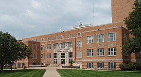
Johnson County, Kansas
Erscheinungsbild

| Vawoitung | |
|---|---|
| US-Bundesstoot: | Kansas |
| Sitz vo da Vawoitung: | Olathe |
| Adress vom Vawoitungssitz: |
County Courthouse 111 South Cherry Olathe, KS 66061-3421 |
| Grindung: | 1855 |
| Buidt aus: | Original-County |
| Vuawoi: | 001 913 |
| Demographie | |
| Eihwohna: | 544.179 (2010) |
| Dichtn: | 440,6 Eihwohna/km² |
| Eadkund | |
| Flächn gesamt: | 1.244 km² |
| Wossaflächn: | 9 km² |
| Koartn | |
 | |
| Hoamseitn: www.jocogov.org | |
Johnson County[1] is a Beziak im Bundesstoot Kansas in da USA. Da Beziak hod 54.4179 Eihwohna. Da Sitz vo da Vawoitung is Olathe.
Da Beziak hod a Fläche vo 1244 Quadratkilometa, dovo san 9 Quadratkilometa Wossafläche.
Gmoana
[Werkeln | Am Gwëntext werkeln]- Bonner Springs
- De Soto
- Edgerton
- Fairway
- Gardner
- Lake Quivira
- Leawood
- Lenexa
- Merriam
- Mission
- Mission Hills
- Mission Woods
- Olathe
- Overland Park
- Prairie Village
- Roeland Park
- Shawnee
- Spring Hill
- Westwood
- Westwood Hills
- Aubry
- Bonita
- Cedar
- Chouteau
- Clare
- Clearview City
- Countryside
- Craig
- Elmhurst
- Frisbie
- Holliday
- Kenneth
- Lackmans
- Monticello
- Morse
- Ocheltree
- Redel
- Stanley
- Stilwell
- Wilder
- Zarah
Beleg
[Werkeln | Am Gwëntext werkeln]- ↑ GNIS-ID: 485010. Abgerufen am 22. Februar 2011 (englisch).
Koordinaten: 38° 47′ N, 94° 41′ W
