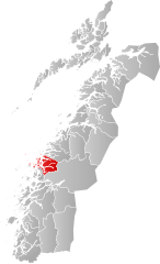
Rødøy
Erscheinungsbild
| Woppn | Koartn | |
|---|---|---|

|
||
| Basisdatn | ||
| Gmoanummara: | 1836 (auf Statistik Norwegen) | |
| Provinz (fylke): | Nordland | |
| Vawoitungssiez: | Vågaholmen | |
| Koordinatn: | 66° 43′ N, 13° 21′ O | |
| Fläch: | 706 km² | |
| Eihwohna: |
1257 (30. Jun. 2017)[1] | |
| Dichtn: | 2 Einwohner je km² | |
| Sproch: | neutral | |
| Postleitzahl: | 8186 | |
| Gliedarung: | Vågaholmen, Gladstad, die Inseln Nesøya, Gjerøya, Rangsundøya, Rødøya und Teile von Hestmona | |
| Hoamseitn: | ||
| Politik | ||
| Buagamoasta: | Olav-Terje Hoff (Sp) (2003) | |
| Log in da Provinz Nordland | ||

| ||
Rødøy is a Kommune in Norwegn in da Fylke Nordland. Im Middloita woar Rødøy oana vo drei Pforrbezirkn in Helgeland. Späta im Middlloita is Helgeland in zwoa Hejftn teit worn: Rødøy und Herøy.
Des Zentrum liegt auf oana Hoibinsl, de vom Melfjord und vom Vælansfjord umgem is. Prägnd is de Fejsformation Rødøyløva, de aa am Woppn („A rota Löwe auf süwam Grund“) des Motiv gem hod. Des Woppn is 1988 ognumma worn. Diese sphinxoatige Fejsformation woar scho vo jeher a wichtige Londmarkn auf da Schiffsroutn an da Küstn.

