Zum Inhalt springen

Westchester County, New York

Aus Wikipedia
(Weidagloadt vo Westchester County)
Vawoitung
US-Bundesstoot: New York
Sitz vo da Vawoitung: White Plains
Grindung: 1683
Buidt aus: Province of New York
Vuawoi: 001 914
Demographie
Eihwohna: 923.459  (2000)
Dichtn: 823,8 Eihwohna/km²
Eadkund
Flächn gesamt: 1.295 km²
Wossaflächn: 174 km²
Koartn
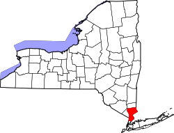
Koartn vo Westchester County innahoib vo New York
Hoamseitn: www.westchestergov.com

Westchester County[1] is a Beziak im Bundesstoot New York in da USA. Da Sitz vo da Vawoitung is White Plains.

Da Beziak hod 923.459 Eiwohna. De Fläche is 1.295 km², davo san 174 km² Wossafläche.

Städt und Gmoana

[Werkeln | Am Gwëntext werkeln]

Citys

  1. Mount Vernon (68.321)
  2. New Rochelle (72.182)
  3. Peekskill (22.441)
  4. Rye (14.955)
  5. White Plains (57.300)
  6. Yonkers (196.086)

Towns

  1. Bedford (18.133)
  2. Cortlandt (38.467)
  3. Eastchester (31.318)
  4. Greenburgh (86.764)
  5. Lewisboro (12.324)
  6. Mamaroneck (28.967)
  7. Mount Pleasant (43.221)
  8. New Castle (17.491)
  9. North Castle (10.849)
  10. North Salem (5.173)
  11. Ossining (36.534)
  12. Pelham (11.866)
  13. Pound Ridge (4.726)
  14. Somers (18.346)
  15. Yorktown (36.318)

Kombiniate Towns/Villages

  1. Harrison (24.154)
  2. Mount Kisco (9.983)
  3. Scarsdale (17.886)

Villages

  1. Ardsley (4.269)
  2. Briarcliff Manor (7.696)
  3. Bronxville (6.543)
  4. Buchanan (2.189)
  5. Croton-on-Hudson (7.606)
  6. Dobbs Ferry (10.622)
  7. Elmsford (4.676)
  8. Hastings-on-Hudson (7.648)
  9. Irvington (6.631)
  10. Larchmont(6.485)
  11. Mamaroneck (18.752)
  12. Ossining (24.010)
  13. Pelham (6.400)
  14. Pelham Manor (5.466)
  15. Pleasantville (7.172)
  16. Port Chester (27.867)
  17. Rye Brook (8.602)
  18. Sleepy Hollow (9.212)
  19. Tarrytown (11.090)
  20. Tuckahoe (6.211)

Census-designated places

  1. Armonk (3.461)
  2. Bedford Village (1.724)
  3. Chappaqua (11.009)
  4. Crompond (2.050)
  5. Crugers (1.752)
  6. Eastchester (18.564)
  7. Fairview (2.887)
  8. Golden's Bridge (1.578)
  9. Greenville (8.648)
  10. Hartsdale (9.830)
  11. Hawthorne (5.083)
  12. Heritage Hills (3.683)
  13. Jefferson Valley (14.891)
  14. Lake Mohegan (5.979)
  15. Lincolndale (2.018)
  16. Peach Lake (1.671) *
  17. Scotts Corners (624)
  18. Shenorock (1.887)
  19. Shrub Oak (1.812)
  20. Thornwood (5.980)
  21. Valhalla (5.379)
  22. Verplanck (777)
  23. Yorktown Heights (7.972)
* Teile des CDP liegen im Putnam County
  1. GNIS-ID: 974157. Abgerufen am 22. Februar 2011 (englisch).

Koordinaten: 41° 7′ N, 73° 48′ W