El Fuerte
Koordinaten: 26° 25′ N, 108° 37′ W
| El Fuerte | ||
|---|---|---|
|
El Fuerte auf da Koartn vo Mexiko | ||
| Basisdatn | ||
| Stoot | Mexiko | |
| Bundesstoot | Sinaloa | |
| Eiwohna | 12.566 (2010) | |
| Detaildatn | ||
| Häh | 90 m | |
| Vuawoi | (+52) 698 | |
| Hoamseitn | ||
 | ||
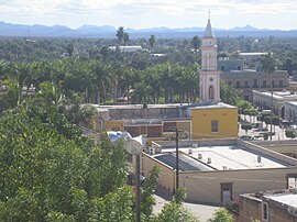
El Fuerte is a ehemolige Haptstod vom mexikanischn Bundesstoot Sinaloa mid 12.566 Eihwohna (Stond: 2010).
Gschicht
[Werkeln | Am Gwëntext werkeln]De Stod is 1563 duachn Spania Francisco de Ibarra grindt worn. 1610 is a Fort earichdt worn, dovo resujtiad aa da Nam: El Fuerte. 1824 is de Stod kuazfristig de Haptstod vo Sonora und Sinaloa worn, mexikanische Bundesstootn, de domois no bis noch Arizona hineigreichd hom. Domois hod de Stod ois Gateway in da USA gojdn. Aa da Goid- und Süwaobbau in de nohen Beag hom wesndli zum Reichtum vom Städtl beidrong, dessn Zentrum no bis heit im Kolonioistui eahoidn is.
CHEPE
[Werkeln | Am Gwëntext werkeln]Duach de Stod fiahd de oanzige grouße, no eahoidane Eisnbohstreckn fian Peasonavakeah in Mexiko, gnennt CHEPE (Ferrocarril Chihuahua al Pacífico). De Bohlinie, de duach de Kupfaschlucht fiahd, vabindt Los Mochis mid Chihuahua. Vui Touristn wejn El Fuerte ois Zuastiegsstation fian CHEPE, do de Stod dogsiwa meah z bietn hod ois Los Mochis. Außadem liegd El Fuerte klimatisch bessa und de Bohstreckn zwischn Los Mochis und El Fuerte is meah oda weniga unspektakulea.
Im Netz
[Werkeln | Am Gwëntext werkeln] Commons: El Fuerte – Sammlung vo Buidl, Videos und Audiodateien
- Offizielle Homepage

