
Northamptonshire
| Northamptonshire Northants (Obkiazung) | |
|---|---|
 | |
| Geografie | |
| Status | Zeremonieje und Vawoitungsgrofschoft |
| Region | East Midlands |
| Fläch | 2.364 [[Quadratkilometa|km²]] |
| Vawoitungssitz | Northampton |
| ISO 3166-2 | GB-NTH |
| Demografie | |
| Bevejkarung Dichtn |
700.576 (2012)[1] 296 / km² |
| Distrikte | |
 | |
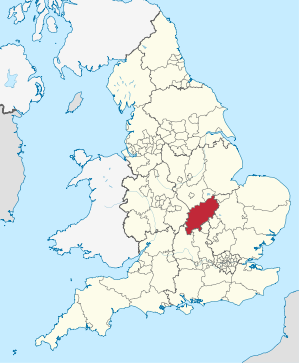
Northamptonshire [nɔːˈθæmptənʃə] (obkiazt: Northants) is a Grofschoft (County) in Zentroiengland. Northamptonshire grenzt on: Warwickshire, Leicestershire, Rutland, Cambridgeshire (mid Peterborough), Bedfordshire, Buckinghamshire (mid Milton Keynes), Oxfordshire und mid ana seah kuazn Grenz (19 Meta) on Lincolnshire. Da Vawoitungssitz befindt si in Northampton.
Da Soke of Peterborough hod friaha zu Northamptonshire ghead.
Städt und Ortschoftn
[Werkeln | Am Gwëntext werkeln]- Brackley, Braunston, Burton Latimer
- Corby
- Daventry, Desborough
- Earls Barton
- Fotheringhay
- Kettering
- Lowick
- Marston St. Lawrence, Middleton, Moulton
- Naseby, Northampton
- Oundle
- Rothwell, Rushden
- Silverstone
- Thrapston, Towcester
- Wellingborough
Sengswiadigkeitn
[Werkeln | Am Gwëntext werkeln]- Althorp House, Sitz vom Earl Spencer
- Boughton House, Sitz vo de Herzäg vo Buccleuch
- Canons Ashby House
- Schloss Ashby, Sitz vom Marquess of Northampton
- Cottesbrooke Hall
- Deene Park
- Delapré Abbey
- Elton Hall
- Kirby Hall, Tei vom English Heritage
- Schloss Rockingham
- Rockingham Motor Speedway
- Rushton Triangular Lodge, Tei vom English Heritage
- Silverstone Circuit
- Stanford Hall
Im Netz
[Werkeln | Am Gwëntext werkeln]Beleg
[Werkeln | Am Gwëntext werkeln]Koordinaten: 52° 18′ N, 0° 51′ W