Smithtown Bay
| Smithtown Bay | ||
|---|---|---|
 Blick vo Nissequogue af Crane Neck | ||
| Gwassa | Long Island Sound | |
| Landmassn | Long Island | |
| Geographische Log | 40° 56′ N, 73° 13′ W | |
| Broadn | ca. 20 km | |
| Zuafliss | Nissequogue River | |
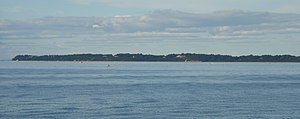
Ois Smithtown Bay wead a Tei vom Long Island Sound on da middlan Noadgstod vo Long Island, om Ufa vo de Städt: Smithtown und Brookhaven, bezeichnd. Se eastreckd se zwischn da Hoibinsl Duck Island im Westn und'm Kap Crane Neck im Ostn, wos om Duachmessa vo uma 20 Kilometa entsprichd. Vo da Vabindungslinie vo de zwoa Punkte eastreckd se de Haptbucht maximoi sechs Kilometa ins Landesinnare, wobei kloanare, stoak obtrennde Nembuchtn wia da Stony Brook Harbor und de Mindung vom Nissequogue River weida eihdringa.
Vo Ost noch West lieng entlong vo da Bucht de Orte: Asharoken, Fort Salonga, Kings Park, Nissequogue, Stony Brook und Old Field, Otei on de Nembuchtn hom aa: Head of the Harbor und da Haptort vo Smithtown. De näxdn, kloanan Buchtn san: westli de Northport Bay und Huntington Bay, estli da Port Jefferson Harbor.

