
Herefordshire
| Grafschofd Herefordshire | ||
|---|---|---|
| ||
 | ||
| Stoot | Vaoanigts Kinireich | |
| Landestei | England | |
| Region | West Midlands | |
| Status | Zeremonieje Grofschoft und Unitary Authority | |
| Ersterwähnung | 1051 | |
| Zeremoneje Grafschofd | ||
| Unitary Authority | ||
| Vawoltungsbeheardn | Herefordshire Council | |
| Vawoitungssiez | Hereford | |
| ISO-3166-2 | GB-HEF | |
| Flechn | 2.180 km² | |
| Eihwohna | 192.107 | |
| Stand | 30. Juni 2018[1] | |
| ONS-Code | 00GA | |
| GSS-Code | E06000019 | |
| NUTS-Code | UKG11 | |
| Website | www.herefordshire.gov.uk | |

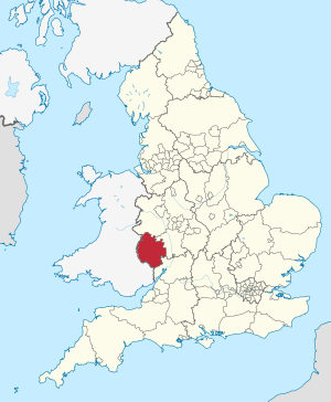
Herefordshire [ˈhɛɹɪfədʃə] is a Grofschoft in da Region West Midlands in England. Herefordshire grenzd on de Grofschoftn: Shropshire im Noadn, Worcestershire im Ostn, Gloucestershire im Sidostn und on de walisischn Grofschoftn Gwent im Sidwestn und Powys im Westn.
Gschicht
[Werkeln | Am Gwëntext werkeln]1974 woa's County mid da Grofschoft Worcestershire za da gmoasoma Grofschoft Hereford and Worcester vabundn worn. Za da domoing Zeid hom de: Distrikte South Herefordshire, Hereford und Tei vo Malvern Hills und Leominster af'm Gebiet vo da heiting Grofschoft bstondn.
Om 1. Aprui 1998 is de Vawoitungsrefom rickgängig gmochd und de Grofschoft in a eingstendigs Gebiet vo om Stodkroas ohne weitane Distrikte (Unitary Authority) iwafiahd worn. Da amtliche Nam vo da Unitary Authority lautd County of Herefordshire.
Herefordshire is a seah ländli pregde Grofschoft, de voa oim van Obstobau lebd.
Gmoana
[Werkeln | Am Gwëntext werkeln]- Adforton
- Bacton, Blackwardine, Bromyard
- Edvin Loach, Eye
- Goodrich
- Hereford, Hoarwithy, Huntington
- Kilpeck, Kington, Kingstone
- Ledbury, Leominster
- Mansel Lacy, Marden, Marston, Marston Stannett, Marstow, Much Marcle
- Pembridge
- Ross-on-Wye
- Thornbury
- Welsh Bicknor, Whitbourne, Whitchurch
Sengswiadigkeitn
[Werkeln | Am Gwëntext werkeln]Im Netz
[Werkeln | Am Gwëntext werkeln]Beleg
[Werkeln | Am Gwëntext werkeln]Koordinaten: 52° 7′ N, 2° 46′ W