Komarowo
| Siedlung vom städtischn Typ
Komarowo
Комарово
| ||||||||||||||||||||||||||||||
| ||||||||||||||||||||||||||||||
| ||||||||||||||||||||||||||||||
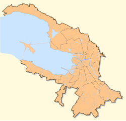
Komarowo (russ. Комарово, finnisch: Kellomäki is a klaane Ortschoft im Rajon Kurort vo Sankt Petersburg am finnischen Meerbusen. Da Ort liegt aun da Eisnbaunlinie Sankt Petersburg – Wyborg, rund 45 km noadwestli vo Petersburg.
Komarowo hod 1230 Eihwohna (Staund: 2010).
Komarowo is ein bedeitenda Kur- und Wohnort vo bekauntn russischn Wissnschoftlan, Künstlan, Schriftstöllan und Schauspülan. Da Ort is owa aa zweng sein Saundstraund, de Wöda und de eiszeitlichn Seen bekaunt.
Persenlichkeiten
[Werkeln | Am Gwëntext werkeln]- Anna Andrejewna Achmatowa, Dichtarin (* 23. Juni 1889, † 5. März 1966)
- Joseph Brodsky, Dichta (* 24. Mai 1940, † 28. Jenna 1996)
- Dmitri Sergejewitsch Lichatschow, Linguist (* 28. Novemba 1906, † 30. Septemba 1999)
- Wera Fjodorowna Panowa, Schriftstöllarin (* 20. Meaz 1905, † 3. März 1973)
- Alissa Brunowna Freindlich, Schauspülarin (* 8. Dezemba 1934)
- Nadeschda Nikolajewna Koschewerowa, Regisseurin (* 23. Septemba 1902, † 22. Feba 1989)
- Matilda Felixowna Kschessinskaja, Ballerina (* 31. August 1872, † 6. Dezemba 1971)
- Galina Sergejewna Ulanowa, Ballerina (* 8. Jenna 1910, † 21. Meaz 1998)
- Boris Grebenschtschikow, Rockmusika (* 27. Novemba 1943)
- Sergei Anatoljewitsch Kurjochin, Rockmusika (* 16. Juni 1954, † 9. Juli 1996)
- Dmitri Dmitrijewitsch Schostakowitsch, Klassischer Komponist (* 25. Septemba 1906, † 9. August 1975)
Literatua
[Werkeln | Am Gwëntext werkeln]- Kellomäki – Komarovo, Komarovo Municipal Council, Balashov et al., Saint Petersburg: Izdatestvo "MKS", 2003, ISBN 5-901810-03-1
- Komarovo Shore - Complex Natural Reserve, Volkova, Isachenko und Khramtsov, Saint Petersburg, 2002, ISBN 5-93938-030-1
Im Netz
[Werkeln | Am Gwëntext werkeln]- komarovo.spb.ru - Offizielle Internetseite von Komarowo (Russisch)
- Kellomäki-Komarowo, Gemeinnützige Organisation (Russisch)
- Komarovo – Geschichte von Komarowo mit vielen Fotos (Russisch)
|
Städte: Kolpino | Krasnoje Selo | Kronstadt | Lomonossow | Pawlowsk | Peterhof | Puschkin | Sankt Petersburg | Selenogorsk | Sestrorezk Siedlungen: Alexandrowskaja | Beloostrow | Komarowo | Lewaschowo | Lissi Nos | Metallostroi | Molodjoschnoje | Pargolowo | Pessotschny | Petro-Slawjanka | Pontonny | Repino | Sapjorny | Schuschary | Serowo | Smoljatschkowo | Solnetschnoje | Strelna | Tjarlewo | Uschkowo | Ust-Ischora |
- ↑ Itogi Vserossijskoj perepisi naselenija 2010 goda. Tom 1. Čislennostʹ i razmeščenie naselenija (Ergebnisse der allrussischen Volkszählung 2010. Band 1. Anzahl und Verteilung der Bevölkerung). Tabellen 5, S. 12–209; 11, S. 312–979 (Download von der Website des Föderalen Dienstes für staatliche Statistik der Russischen Föderation)


